
The Dutch company VanderSat and the German chemical group BASF are offering farmers the ability to see through clouds using a new type of satellite imagery.
VanderSat has developed a technology that allows, for example, dried-out plants to be detected under all weather conditions. This makes use of satellite images with microwaves.
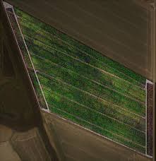
Satellite images have been used in agriculture worldwide for several years. "In the Netherlands, farm plots are not very large and farmers know very well what is happening on their land. But in other parts of the world, such as North and Latin America, they often have vast stretches of land. And it is crucial for them to know what is going on," said director Thijs van Leeuwen. "This way, they can make targeted use of their scarce resources like water, fertilizers, and pesticides."
Promotion
Until now, farmers could examine how green their crops were. That only works when clouds do not obstruct the view. With the Dutch innovation, microwaves captured by satellites from plants and soil are used. This allows farmers to see the condition of their crops even with heavy cloud cover.
For crop analysis, VanderSat utilizes satellite data from the European Space Agency (ESA). The company expects the technology to be accessible and affordable in poorer regions of the world as well.
According to the company, the analyses are particularly accurate, as reported by the Belgian weekly Landbouwleven. However, farmers cannot see how each individual plant is growing. The data pertains to field registrations of 10 by 10 meters.